Campus Environmental Safety
Campus Safety Network Mechanism
The University established a Campus Safety and Disaster Response Center to address risks such as earthquakes, fires, traffic accidents, infectious diseases, and food safety. Through real-time reporting, rapid response, training, and equipment upgrades, disaster probability and impact are effectively reduced (see Section 4-1 Climate Change Response).
By implementing regular inspections, early-warning alerts, and tiered response protocols, disaster resilience is strengthened. A 24/7 monitoring system, supported by community police and campus security, ensures quick handling of emergencies.The campus is equipped with five emergency systems and 796 call stations, continuously upgraded, along with a Mobile Campus Safety Center to enhance efficiency and protection.
|
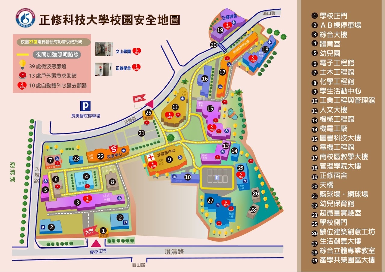
▲Campus Safety Map |
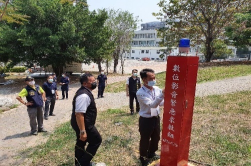
▲Digital Audio-Visual Emergency Call Button |
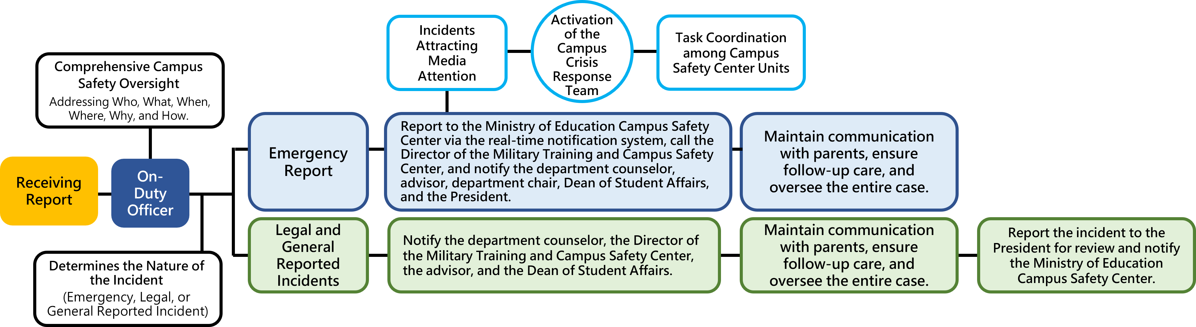
Campus Security Incident Classification and Response Command
Disaster Risk Assessment
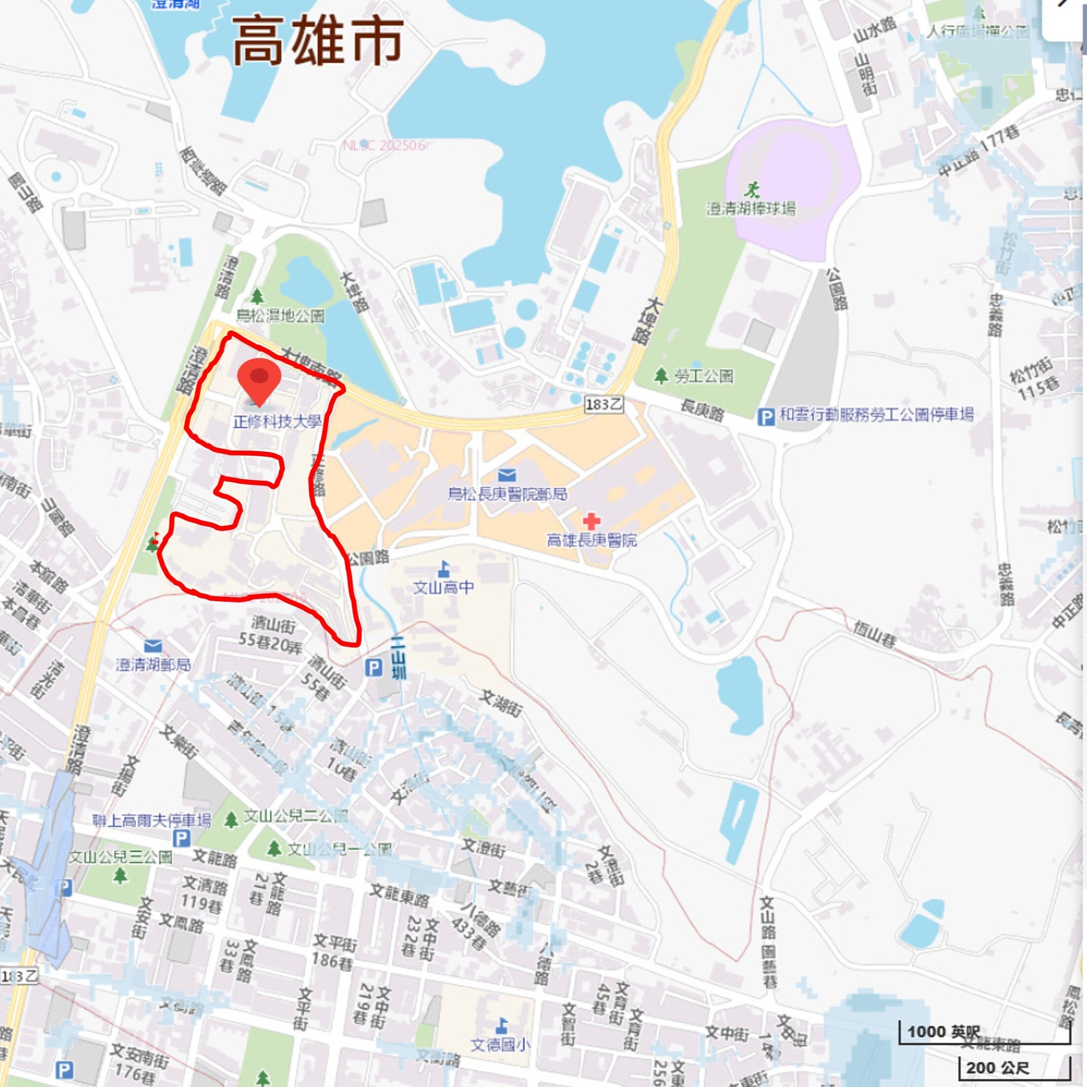
Cheng Shiu University conducts disaster risk reviews based on hazard potential maps provided by the Ministry of Education’s Disaster Prevention Education GIS platform and the National Science and Technology Center for Disaster Reduction. Potential risks on campus and in surrounding areas are identified through environmental safety inspections and on-site surveys, enabling early detection and the implementation of disaster prevention and mitigation measures. According to the analysis, within a 500-meter radius of the campus there are areas with flooding potential (dark blue zones), while the campus itself is located in a low soil-liquefaction potential area for earthquakes (green zone).
|
▲Flood Hazard Potential Map |
▲Soil Liquefaction Potential Map |
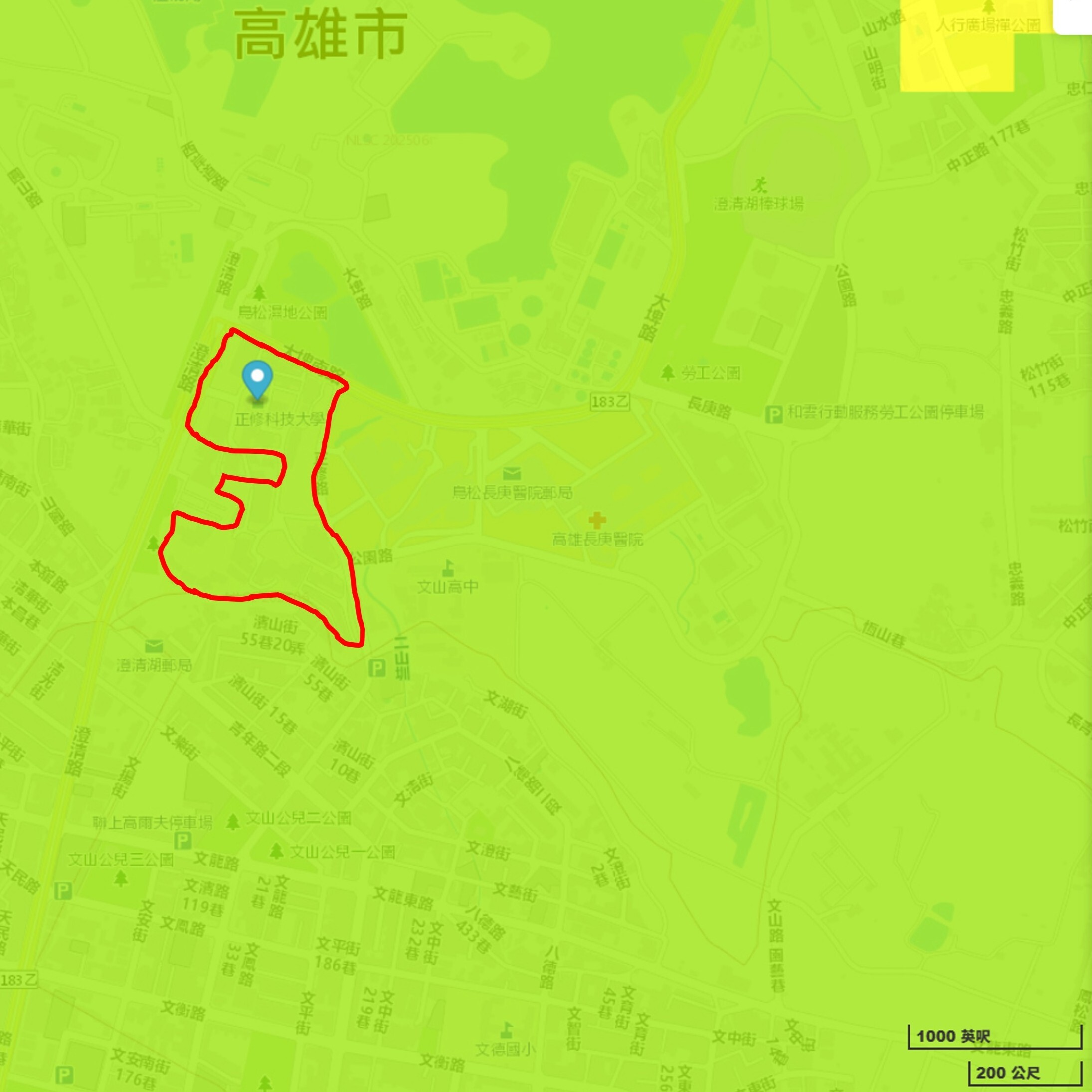
Disaster Potential Analysis of The Campus and Surrounding Areas
|
Cheng Shiu University is located in Niaosong Village, Niaosong District, Kaohsiung City, |
|||
|
Disaster Type |
Hazard Potential |
Presence of Hazard Potential |
Detailed Description |
|
Flood Potential |
6-hour Rainfall of 350 mm Potential Zone |
Yes |
Not directly located in the 6-hour rainfall of 350 mm potential zone, but within 500 meters of such a zone. |
|
12-hour Rainfall of 400 mm Potential Zone |
Yes |
Not directly located in the 12-hour rainfall of 400 mm potential zone, but within 500 meters of such a zone. |
|
|
24-hour Rainfall of 500 mm Potential Zone |
Yes |
Not directly located in the 24-hour rainfall of 500 mm potential zone, but within 500 meters of such a zone. |
|
|
24-hour Rainfall of 650 mm Potential Zone |
Yes |
Not directly located in the 24-hour rainfall of 650 mm potential zone, but within 500 meters of such a zone. |
|
|
Debris Flow and Landslide |
Debris Flow Potential Streams |
No |
|
|
Large-Scale Landslide Potential Areas |
No |
No potential area within 500 meters. |
|
|
Dip-Slope Areas |
No |
No potential area within 500 meters. |
|
|
Rock Mass Sliding |
No |
No potential area within 500 meters. |
|
|
Rockfall and Debris Slide |
No |
No potential area within 500 meters. |
|
|
Rockfall |
No |
No potential area within 500 meters. |
|
|
Faults and Soil Liquefaction |
Soil Liquefaction Potential Zone |
Yes |
Low potential. |
|
Active Fault |
No |
No potential area within 500 meters of a fault-sensitive zone. |
|
|
Tsunami Inundation and Coastal Hazards |
Tsunami Inundation Potential Zone |
No |
|
|
Volcanic Potential |
Volcanic Potential |
No |
Within Volcanic Potential Zone. |
|
Nuclear Accident Emergency Response Zone |
Nuclear Accident Emergency Response Zone |
No |
|
Note: Criteria for assessment: (1) Directly located within a hazard potential zone; (2) Not directly within the zone, but within 500 meters of it; (3) No hazard potential zone within 500 meters.
Campus Disaster Management and Emergency Response
To strengthen resilience against extreme climate events and enhance emergency response capacity, Cheng Shiu University has established the Campus Safety and Disaster Prevention Response Center, which develops and implements various safety and disaster education programs:
|
● Promote disaster prevention education and drills to improve faculty and students’ knowledge, awareness, and skills in earthquake safety, evacuation, and self-protection. When facing complex disasters without immediate external rescue support, the campus community is trained to carry out emergency evacuation, first aid, and sheltering, achieving “on-site refuge and self-protection” to minimize losses and ensure safety of people, property, operations, and peace of mind. |
|
● Formulate operational guidelines for the Campus Safety and Disaster Prevention Response Center, with standardized response procedures covering routine incidents, major campus emergencies, and national-level disasters (e.g., earthquakes, typhoons, floods). |
|
● Establish disaster early-warning systems and hazard maps, publicly displayed on campus bulletin boards and the University website. |
|
● Install emergency facilities: 5 emergency call systems, 796 emergency call buttons (telephones), 13 outdoor digital audio-visual SOS devices, 1,000 surveillance cameras, 39 microwave-sensor lights in remote or dark areas, and 10 AEDs (Automated External Defibrillators), all subject to regular inspection and maintenance. |
|
● Conduct annual National Disaster Prevention Day drills, including earthquake evacuation and cover drills, dormitory evacuation, laboratory fire response, and hands-on firefighting exercises. |
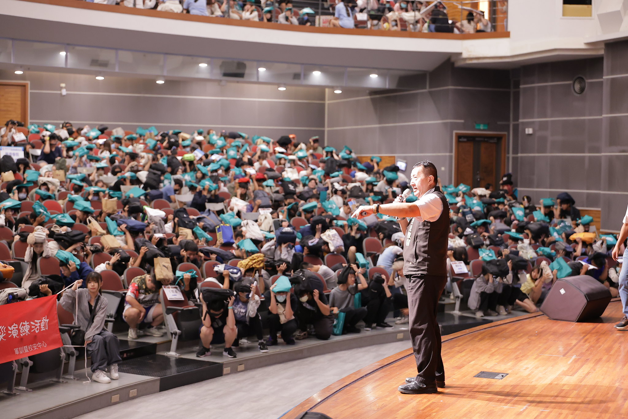
Earthquake and Disaster Preparedness Education
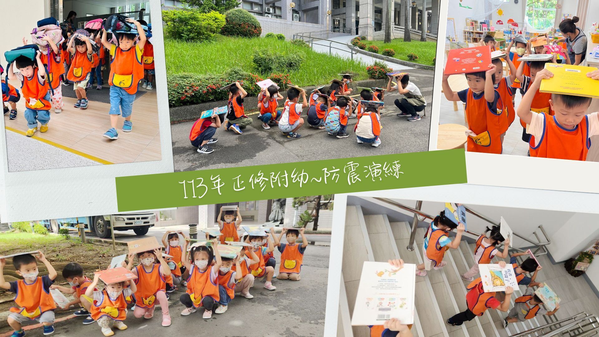
To strengthen student safety awareness, the University organizes the National Disaster Prevention Day Program each year. Activities include earthquake preparedness education, evacuation drills, and workshops to familiarize students with safety protocols and support national defense objectives. Integrated with the All-out Defense Education curriculum, all faculty and students are required to practice “Drop, Cover, and Hold On,” evacuation routes, and roll calls to ensure full understanding.
In 2024, the University conducted six campus-wide drills and awareness activities (including freshman orientation, assemblies, kindergarten, dormitories, and academic buildings), with a total of 10,858 participants.
|
▲Campus-wide Assembly on Earthquake Preparedness Education |
▲Kindergarten Earthquake Drill |
Traffic Safety Education
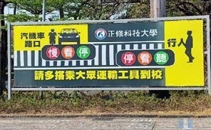
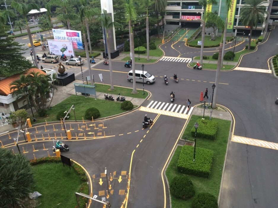
To foster safe traffic habits and ensure the well-being of faculty and students, the university has implemented a Traffic Safety Education Plan and established a Traffic Safety Committee, chaired by the President with the Dean of Student Affairs and the Director of the Military Training and Campus Safety Center as executive secretaries. The committee meets once per semester to address campus traffic issues.
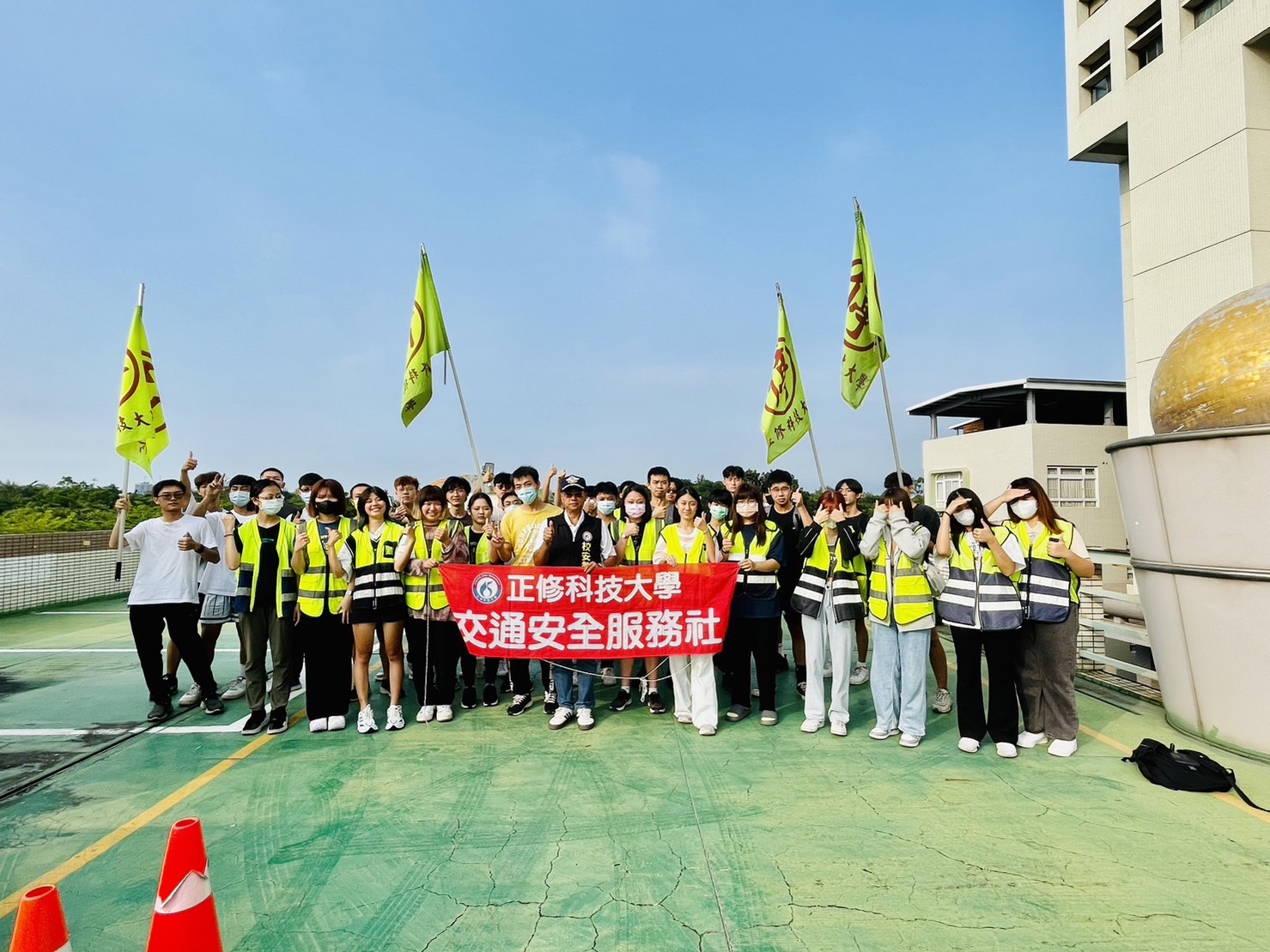
Traffic safety education is promoted through various channels, including freshman orientation, campus-wide assemblies, and departmental meetings, with experts invited to deliver lectures. Experiential activities integrate traffic safety with life education, emphasizing motorcycle riding safety. A Traffic Safety Service Club and Student Traffic Patrol Team were formed to assist with traffic control and order maintenance. These efforts aim to reduce accidents and create a safer campus environment.
Green Transportation and Campus Safety Management Strategies
|
Strategic Aspect |
Specific Measures |
Performance and Outcomes |
|
Campus Traffic Safety Control |
● Follow the Access Control and Parking Management Guidelines, enforcing strict vehicle entry applications and ID renewal procedures. ● Vehicles entering teaching zones must obtain prior approval. ● Campus security staff and the Student Traffic Patrol assist with traffic control during peak hours. ● Designated lanes separate cars, motorcycles, and pedestrians. |
Improve campus traffic order and pedestrian safety, reducing vehicle–pedestrian conflicts. |
|
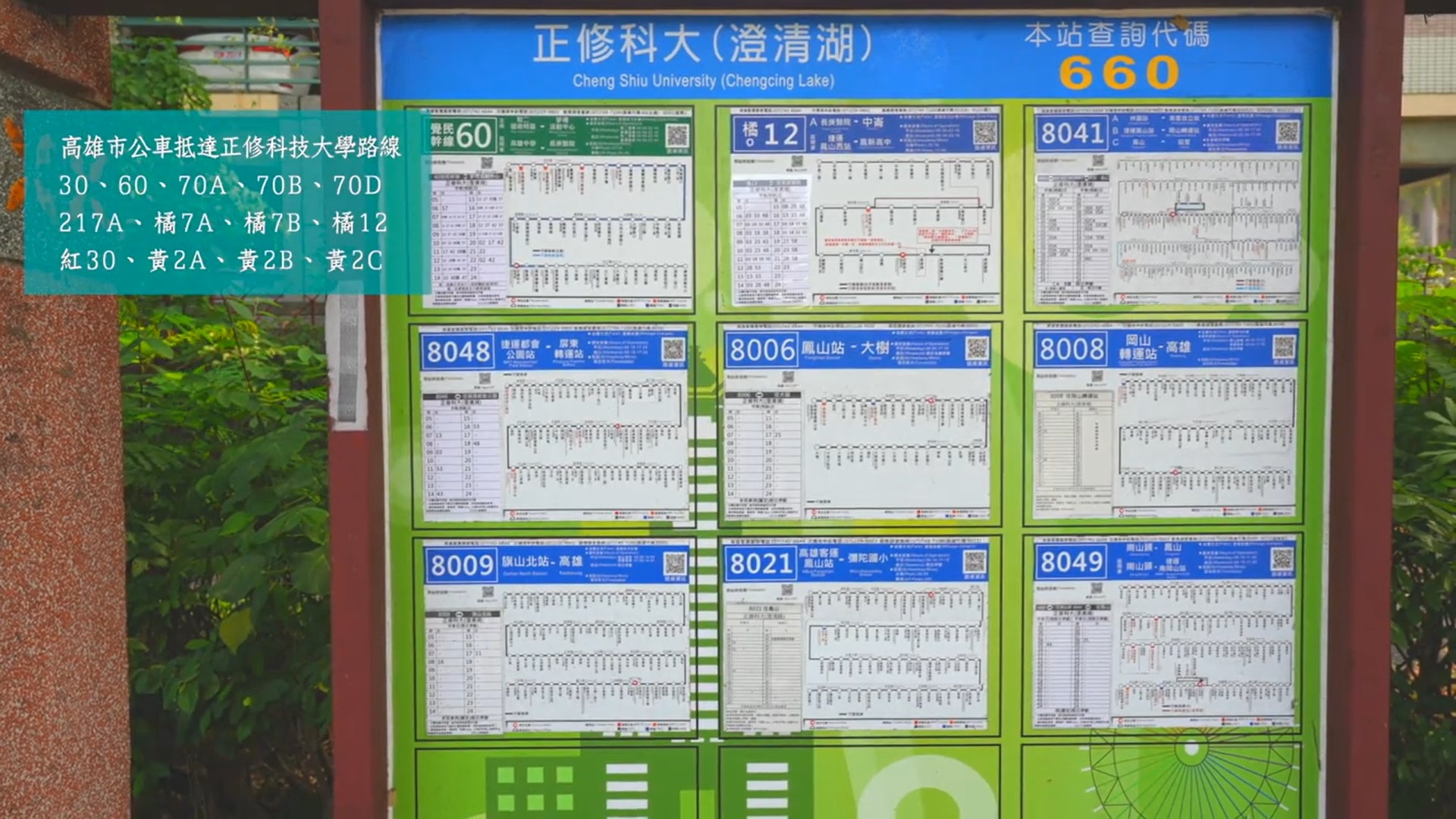
Promotion of Public Transportation |
● Multiple Kaohsiung City bus and intercity routes provide direct access to campus. ● Faculty, staff, and students are encouraged to use public transportation. |
Decrease private car and motorcycle use to save energy, cut carbon emissions, and ease traffic congestion around campus. |
|
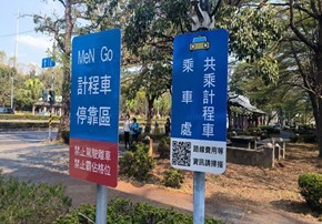
Implementation of Taxi Ride-Sharing |
● In cooperation with the city government, promote taxi ride-sharing programs (4–6 passengers). ● Implement transparent fare-sharing with professional taxi services. |
Provide safe, convenient, and affordable commuting options, fostering a culture of ride-sharing and resource sharing. |
|
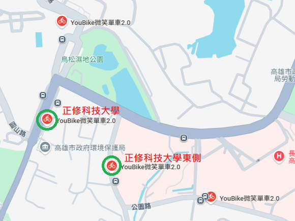
Encouragement of Bicycle Commuting |
● Two YouBike stations are installed at the main and side gates. ● Encourage short-distance commuting by bicycle. ● Provide free parking zones designated for bicycles. |
Reduce emissions and congestion while promoting health and enhancing the university’s green image. |
|
▲Campaign promoting public transportation to campus |
▲Designated taxi ride-sharing stops |
|
▲ Multiple Kaohsiung City bus |
▲ Two YouBike stations are installed at the main and side gates. |
According to the Ministry of Transportation and Communications (MOTC) Road Traffic Safety Data Inquiry System, the area within 500 meters of the university (yellow zone) includes identified accident hotspots (dark blue points), as shown in the figure. The university has continued to implement traffic safety measures to protect pedestrians on campus, resulting in a steady decline in nearby accident cases. In 2024, a total of 45 traffic accidents occurred within 500 meters of the campus, representing a 50% reduction compared to the 2019 baseline year.
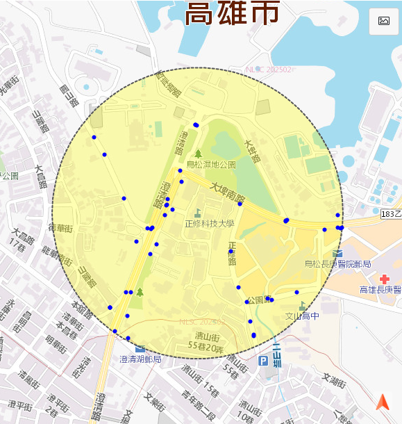
Note: Source - MOTC Road Traffic Safety Data Inquiry System – School Vicinity Accident Hotspots.
Accidents and Casualties Near Campus
|
Year |
Number of Injuries |
Number of Accidents |
Number of Fatalities |
|
2019 |
128 |
90 |
0 |
|
2020 |
80 |
57 |
0 |
|
2021 |
88 |
66 |
0 |
|
2022 |
68 |
58 |
1 |
|
2023 |
53 |
43 |
0 |
|
2024 |
55 |
45 |
0 |
Note: Data source — Ministry of Transportation and Communications, Directorate General of Highways and Road Safety Division, Road Safety Information Inquiry System. The statistics on accident hotspots around the university include cases involving the general public.
Campus Safety and Disaster Preparedness Education – Implementation Overview
|
Activity Name |
Impact / Effectiveness |
|
Campus Safety Awareness Program Series |
● In 2024, in line with the Ministry of Education’s Friendly Campus Week, four campus safety awareness sessions were held. ● In addition, a safety banner and digital poster design competition was organized, with 662 participants, enhancing students’ awareness and engagement in campus safety. |
|
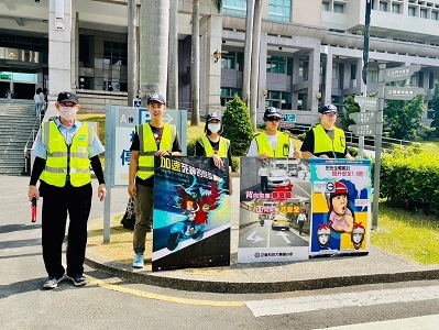
Traffic Safety Promotion Activity |
● Implemented professional training for the Student Traffic Safety Team, held initial, midterm, and final review meetings, and conducted safety promotion, violation counseling, and a creative helmet painting competition. ● In the 2024 academic year, a total of 8 traffic safety awareness sessions and 6 guidance and training activities were held, with 810 participants, effectively improving students’ traffic safety knowledge. |
|
▲ Traffic Safety Education – Motorcycle Violation Registration and Counseling |
▲Professional training for the Student Traffic Patrol |
|
▲ Campus Traffic Safety Control |
▲ Pedestrian lane |

Campus Food Safety
In accordance with the Regulations for the Establishment of the Health and Dietary Committee, the University established the Health and Dietary Committee, chaired by the President, with the Director of the Student Life and Health Section serving as Executive Secretary. The committee convenes at least once per academic year to coordinate and discuss major issues related to food and dining hygiene, thereby preventing food safety incidents.
Cafeteria Hygiene Supervision
The University engages a part-time nutritionist from Chang Gung Memorial Hospital to conduct cafeteria hygiene inspections at least once a week. Based on the inspection results, the Student Life and Health Section implements improvements accordingly, with records kept through the Student Cafeteria Hygiene Audit Form for future reference.
Food Hygiene Management
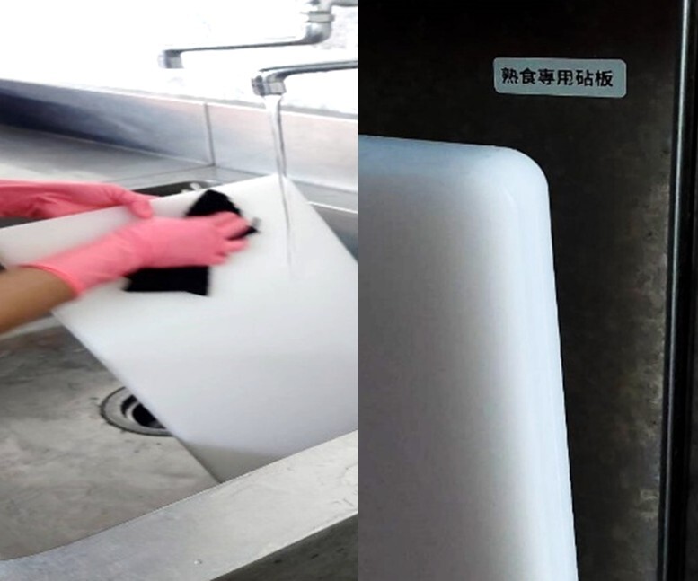
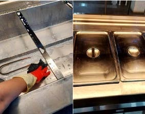
According to regulations, all on-campus food service providers are subject to the Ministry of Education’s annual hygiene guidance visits. In the 2023 academic year, one vendor received counseling, with the site visit completed on May 3, 2024, and all required improvements carried out. For the 2024 academic year, another visit is scheduled for May 14, 2025. The vendor under review, a self-service cafeteria, has completed the required improvements as follows:
● Kept exhaust hoods and fans clean at all times, strengthened pest control, and ensured food was properly covered in compliance with workplace hygiene requirements.
● Repaired lighting fixtures above the food preparation area.
● Ensured frozen food was properly covered, homemade sauces were sealed and stored to maintain freshness and safety, and temperature logs were accurately maintained, complying with food acceptance, handling, and storage standards.
● Replaced chopping boards and clearly labeled raw/cooked food preparation zones to comply with hygienic food preparation and meal service practices.
|
|
|
Campus Infectious Disease Prevention
The University places great importance on the prevention of infectious diseases on campus, recognizing it as a cornerstone in safeguarding students’ physical and mental health as well as maintaining a high-quality learning environment. To this end, the Cheng Shiu University Regulations for Infectious Disease Prevention have been established, with implementation carried out in accordance with the standardized Campus Infectious Disease Prevention Standard Operating Procedure (SOP) Flowchart.
In response to the potential risks of infection associated with densely populated environments and frequent interactions among faculty, staff, and students, the University has implemented comprehensive measures including health education campaigns, promotion of proper hygiene practices, regular health check-ups, vaccination programs, and an effective infectious disease reporting system to reduce the risk of disease transmission.
Furthermore, the University collaborates with local communities and parents to establish a cooperative epidemic prevention network, thereby creating a healthy, safe, and reassuring learning environment that supports students’ steady growth and holistic development.
|
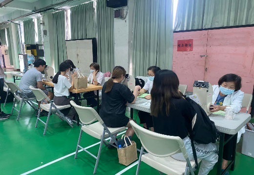
▲Freshmen Health Check-ups |
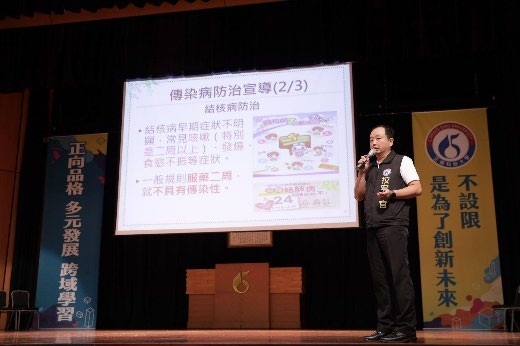
▲Health Education Sessions in Departmental Meetings |